- Rating: EF-0
- Beginning Location: 4 miles NW of Tomahawk, WV (39.551, -78.111)
- End Location: 4 miles NW of Tomahawk, WV (39.557, -78.111)
- County: Berkeley
- Start Time: 11:50 p.m.
- End Time: 11:52 p.m.
- Estimated Peak Wind: Unknown
- Path Length: 0.49 miles
- Path Width Maximum: 150 yards
- Fatalities: 0
- Injuries: 0
- Property Damage: $50,000
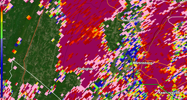
Details from NWS storm survey: The remnants of Tropical Cyclone Debby spawned a few tornadoes in northern Virginia and eastern West Virginia. Berkeley County WV Emergency Management and the National Weather Service Baltimore/Washington Forecast Office conducted a survey of storm damage that occurred near Hedgesville in Berkeley County, West Virginia on Thursday night, August 08, 2024. NWS Doppler Weather Radar in Sterling, Virginia showed a rotating thunderstorm that developed a tornado based on this survey. The damage was first noticed at 11:50 PM EDT around the intersection of Wampum Lane and Lodge Road where a large tree was uprooted and branches were snapped. The tornado continued on a path to the northwest where most of the damage was concentrated on Brumbaugh Lane at 11:51 PM EDT. Several trees were uprooted and a few trees were snapped about midway up. Numerous large branches were down across the area as well. The direction of the damage appeared to be chaotic. The last noted damage was along the 200 block of Mound Builder Loop where several trees were uprooted and one snapped.
Radar Imagery
Base Reflectivity Image (Doppler Radar) Near Time of Tornado
Base Velocity Image Near Time of Tornado
Normalized Rotation Image Near Time of Tornado
Correlation Coefficient Image Near Time of Tornado
4-Panel Still Image
4-Panel Loop


